 |
|
|
|
|
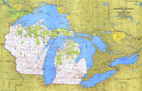
Wisconsin, Michigan, And The Great Lakes Map 1973
Issue: August 1973
|
|
|
|
|
|
|
| Product Highlights |
| Wisconsin, Michigan, And The Great Lakes Map 1973 |
| Item#: X NGC 081973a |
Explore the vacation areas and sites of the Great Lakes region with the Wisconsin, Michigan, and the Great Lakes map. Published in August 1973 as part of the "Close-up: U.S.A." series, this map was accompanied by a travel map entitled "Wisconsin, Michigan, and the Great Lakes: Land Between the Waters." The 1973 Wisconsin, Michigan, and the Great Lakes map features:
• Tourist activities and points of interest noted
• National parks, state and provincial parks, wildlife refuges, national and state forests, Indian reservations, and more
• Recreational trails and wild or scenic rivers
• Capitals, cities, and towns
• Interstate highways, other roads, passenger railroads, canals, and airports
• Rivers, lakes, and swamps
• Ski areas
Coverage Area: Wisconsin, Michigan, Great Lakes
|
|
 |
More Product Details
This map requires 7 business days to print and laminate prior to shipping.
Appearing in the August 1973 issue of the National Geographic Magazine, this Wisconsin, Michigan, And The Great Lakes map has been reproduced from its original cartography in order to bring to life a beautiful poster previously only seen in National Geographic Magazine. This reproduction holds true to the high standards that National Geographic Maps are known for.
Perfect for home, office or classroom, this map also makes a great gift. Map collectors will surely want to add this map to their library.
The Paper version is printed on high quaility semi-gloss paper, perfect for framing.
The Laminated version uses 3mm laminate on both sides for durability, is easy to clean and markable.
From the National Geographic Classic Maps collection, this reproduction is just one of hundreds of titles available here. These maps are Printed on Demand. Sizes are approximate and may vary due to the nature of the trimming and laminating processes.
|
|
Shipping Conditions
Maps.com ships to Dometic US only
 | This product can only be shipped to the Domestic U.S.A. (No APO's or PO Boxes) |  | This map requires 2 business days to print and laminate prior to shipping. |
|
|
|
|


 Click here to zoom!