SHOP BY YEAR :: FOR OFFICE :: FOR CLASSROOM :: GIFT IDEAS :: CUSTOMER SERVICE

North America Map 1924
Issue: May 1924
More Views
Enlarge Image
ZoomClick here to zoom!
Purchase Product :
Please select map format:
Laminated   
28" x 38" - $59.95
Laminated-w/Plastic Rails  (What are rails?)
28" x 38" - $76.95
Paper
28" x 38" - $49.95
Wallzilla Adhesive Format
28" x 38" - $89.95
Product Highlights
North America Map 1924
Item#: X NGC 051924

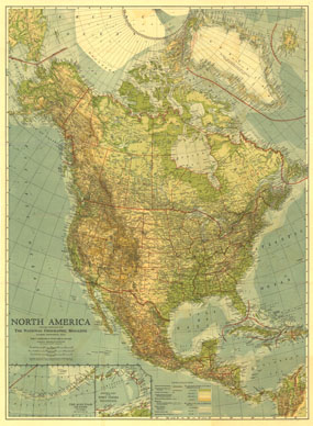
Published in May 1924, this beautiful map of North America is colored to indicate elevation and ocean depth, and features boldly drawn state, provincial, and international boundaries. Inset maps of the Aleutian Islands and the eastern part of the West Indies complete this attractive presentation of the region.

The 1924 North America map features:
• Inset maps of the eastern part of the West Indies and the Aleutian Islands
• Elevation of land and depth of ocean indicated by color
• Capitals of countries, states, provinces, and colonies, and major cities
• Mountain ranges, major rivers, major lakes, glaciers and ice caps, and approximate limit of pack ice
• Principal transcontinental railroad lines and other important railroad lines
• Ocean currents
• Stations of Hudson's Bay Co.

Coverage Area: North America, Greenland, Iceland, Central America, West Indies

More Product Details

This map requires 7 business days to print and laminate prior to shipping.

Appearing in the May 1924 issue of the National Geographic Magazine, this North America map has been reproduced from its original cartography in order to bring to life a beautiful poster previously only seen in National Geographic Magazine. This reproduction holds true to the high standards that National Geographic Maps are known for.

Perfect for home, office or classroom, this map also makes a great gift. Map collectors will surely want to add this map to their library.

The Paper version is printed on high quaility semi-gloss paper, perfect for framing.

The Laminated version uses 3mm laminate on both sides for durability, is easy to clean and markable.

From the National Geographic Classic Maps collection, this reproduction is just one of hundreds of titles available here. These maps are Printed on Demand. Sizes are approximate and may vary due to the nature of the trimming and laminating processes.
Shipping Conditions
Maps.com ships to Dometic US only

US FlagThis product can only be shipped to the Domestic U.S.A. (No APO's or PO Boxes)
TimeThis map requires 2 business days to print and laminate prior to shipping.