 |
|
|
|
|
Mexico And Central America Map 1980
Issue: December 1980
|
|
|
|
|
|
|
| Product Highlights |
| Mexico And Central America Map 1980 |
| Item#: X NGC 121980a |
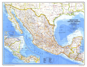
The magnificent Aztec civilization left an abundance of temples, pyramids, and ruins throughout Mexico and parts of Guatemala. The Mexico and Central America map published in December 1980 accompanied two articles on the Aztecs and a companion map entitled "Visitor's Guide to the Aztec World" was printed in the same issue. The 1980 Mexico and Central America map features:
• Insets of southern Central America, Guadalupe Island, and the Revillagigedo Islands
• Capitals, cities, and towns
• Mountains, rivers, lakes, intermittent lakes, and dry salt lakes
• Pan-American highway system, roads, railroads, canals, and airports
• Ocean bathymetry
• Ruins
• Oil fields and pipelines
Coverage Area: Mexico, Central America
|
|
 |
More Product Details
This map requires 7 business days to print and laminate prior to shipping.
Appearing in the December 1980 issue of the National Geographic Magazine, this Mexico And Central America map has been reproduced from its original cartography in order to bring to life a beautiful poster previously only seen in National Geographic Magazine. This reproduction holds true to the high standards that National Geographic Maps are known for.
Perfect for home, office or classroom, this map also makes a great gift. Map collectors will surely want to add this map to their library.
The Paper version is printed on high quaility semi-gloss paper, perfect for framing.
The Laminated version uses 3mm laminate on both sides for durability, is easy to clean and markable.
From the National Geographic Classic Maps collection, this reproduction is just one of hundreds of titles available here. These maps are Printed on Demand. Sizes are approximate and may vary due to the nature of the trimming and laminating processes.
|
|
Shipping Conditions
Maps.com ships to Dometic US only
 | This product can only be shipped to the Domestic U.S.A. (No APO's or PO Boxes) |  | This map requires 2 business days to print and laminate prior to shipping. |
|
|
|
|


 Click here to zoom!