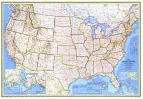
This beautiful US map, published in July of 1976, is a National Geographic classic. A perfect companion to the US maps of 1961 and 1968, this US map combines artistry and detail that make it a classic among US maps. The 1976 United States map features:
• Coverage of all 50 states, with beautiful insets for Hawaii and Alaska
• Thousands of place names, including state capitals, cities, and towns
• Mountain ranges with beautiful relief shading
• Interstates, major roads, rivers, lakes, mountain ranges, elevations and depth soundings in the oceans
• Inset for Alaska shows an inset within an inset with detail for the Fairbanks to Anchorage region
• Inset showing the US and its principal outlying territories
• Dual insets for Hawaii show the main islands and the entire chain of islands
Coverage Area: United States, Alaska, Hawaii
|


 Click here to zoom!
