SHOP BY YEAR :: FOR OFFICE :: FOR CLASSROOM :: GIFT IDEAS :: CUSTOMER SERVICE

North Central United States Map 1958
Issue: November 1958
More Views
Enlarge Image
ZoomClick here to zoom!
Purchase Product :
Please select map format:
Laminated   
19" x 25" - $19.95
Laminated-w/Plastic Rails  (What are rails?)
19" x 25" - $29.95
Paper
19" x 25" - $14.95
Wallzilla Adhesive Format
19" x 25" - $34.95
Product Highlights
North Central United States Map 1958
Item#: X NGC 111958

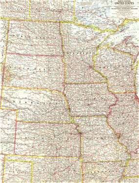
Published in November 1958, the North Central States map focused on the states of North Dakota, South Dakota, Minnesota, Nebraska, Iowa, Wisconsin, Illinois, Missouri, and Kansas. This detailed map of the heartland accompanied an article entitled "The Upper Mississippi."

The 1958 North Central United States map features:
• State capitals, cities, and towns
• Freeways, toll roads, roads, railroads, canals, and places with scheduled air service
• Great Lakes bathymetry
• National parks and monuments
• Mountains, rivers and major lakes

Coverage Area: North Dakota, South Dakota, Minnesota, Nebraska, Iowa, Wisconsin, Illinois, Missouri, Kansas, northern Oklahoma, northern Arkansas, southern Manitoba, southeastern Saskatchewan, southwestern Ontario

More Product Details

This map requires 7 business days to print and laminate prior to shipping.

Appearing in the November 1958 issue of the National Geographic Magazine, this North Central United States map has been reproduced from its original cartography in order to bring to life a beautiful poster previously only seen in National Geographic Magazine. This reproduction holds true to the high standards that National Geographic Maps are known for.

Perfect for home, office or classroom, this map also makes a great gift. Map collectors will surely want to add this map to their library.

The Paper version is printed on high quaility semi-gloss paper, perfect for framing.

The Laminated version uses 3mm laminate on both sides for durability, is easy to clean and markable.

From the National Geographic Classic Maps collection, this reproduction is just one of hundreds of titles available here. These maps are Printed on Demand. Sizes are approximate and may vary due to the nature of the trimming and laminating processes.
Shipping Conditions
Maps.com ships to Dometic US only

US FlagThis product can only be shipped to the Domestic U.S.A. (No APO's or PO Boxes)
TimeThis map requires 2 business days to print and laminate prior to shipping.