SHOP BY YEAR :: FOR OFFICE :: FOR CLASSROOM :: GIFT IDEAS :: CUSTOMER SERVICE

Northern Plains Map 1986 Side 1
Issue: December 1986
More Views
Enlarge Image
ZoomClick here to zoom!
Purchase Product :
Please select map format:
Laminated   
27" x 20" - $39.95
Laminated-w/Plastic Rails  (What are rails?)
27" x 20" - $51.95
Paper
27" x 20" - $29.95
Wallzilla Adhesive Format
27" x 20" - $59.95
Product Highlights
Northern Plains Map 1986 Side 1
Item#: X NGC 121986a

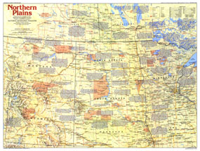
Part of the "Making of America" series, the Northern Plains map contains a wealth of historical notes and a variety of points of interest including the site of the battle of Little Bighorn, the Oregon-Mormon Trail, and Mount Rushmore. This map represents Side One of a two-map set published in December 1986. It accompanied the article "Ghosts on the Little Bighorn."

The 1986 Northern Plains map Side 1 features:
• An abundance of historical notes and information on points of interest
• U.S. national parks, Canadian national parks, Indian reservations or reserves, trails, battlefields, mining areas, and ghost towns
• Capitals, cities, and towns
• Interstate highways, major roads, other roads, passenger railroads, and scheduled air service
• Mountains, rivers, and lakes

Coverage Area: Montana, Wyoming, North Dakota, South Dakota, Minnesota, northern Nebraska, northen Iowa, southern Saskatchewan, southern Manitoba, southern Ontario

More Product Details

This map requires 7 business days to print and laminate prior to shipping.

Appearing in the December 1986 issue of the National Geographic Magazine, this Northern Plains map Side 1 has been reproduced from its original cartography in order to bring to life a beautiful poster previously only seen in National Geographic Magazine. This reproduction holds true to the high standards that National Geographic Maps are known for.

Perfect for home, office or classroom, this map also makes a great gift. Map collectors will surely want to add this map to their library.

The Paper version is printed on high quaility semi-gloss paper, perfect for framing.

The Laminated version uses 3mm laminate on both sides for durability, is easy to clean and markable.

From the National Geographic Classic Maps collection, this reproduction is just one of hundreds of titles available here. These maps are Printed on Demand. Sizes are approximate and may vary due to the nature of the trimming and laminating processes.
Shipping Conditions
Maps.com ships to Dometic US only

US FlagThis product can only be shipped to the Domestic U.S.A. (No APO's or PO Boxes)
TimeThis map requires 2 business days to print and laminate prior to shipping.