 |
|
|
|
|
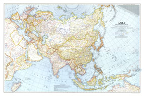
Asia, And Adjacent Areas Map 1942
Issue: December 1942
|
|
|
|
|
|
|
| Product Highlights |
| Asia, And Adjacent Areas Map 1942 |
| Item#: X NGC 121942 |
Battles were raging in Asia, Europe, and Africa at the time of this map's publication in December 1943. International boundaries on this map are as of September 1, 1939, the day Germany invaded Poland. The 1942 Asia and Adjacent Areas map features:
• Thousands of place names including capitals, cities, and towns
• Airline distances
• Principal railways, railways under construction, important routes, trails, and canals
• Mountains, passes, rivers, lakes, deserts, glaciers, and areas below sea level
• Ruins and the Great Wall of China
• Oil pipelines
• Geographical equivalents
Coverage Area: Asia, Europe, northeastern Africa
|
|
 |
More Product Details
This map requires 7 business days to print and laminate prior to shipping.
Appearing in the December 1942 issue of the National Geographic Magazine, this Asia, And Adjacent Areas map has been reproduced from its original cartography in order to bring to life a beautiful poster previously only seen in National Geographic Magazine. This reproduction holds true to the high standards that National Geographic Maps are known for.
Perfect for home, office or classroom, this map also makes a great gift. Map collectors will surely want to add this map to their library.
The Paper version is printed on high quaility semi-gloss paper, perfect for framing.
The Laminated version uses 3mm laminate on both sides for durability, is easy to clean and markable.
From the National Geographic Classic Maps collection, this reproduction is just one of hundreds of titles available here. These maps are Printed on Demand. Sizes are approximate and may vary due to the nature of the trimming and laminating processes.
|
|
Shipping Conditions
Maps.com ships to Dometic US only
 | This product can only be shipped to the Domestic U.S.A. (No APO's or PO Boxes) |  | This map requires 2 business days to print and laminate prior to shipping. |
|
|
|
|


 Click here to zoom!