SHOP BY YEAR :: FOR OFFICE :: FOR CLASSROOM :: GIFT IDEAS :: CUSTOMER SERVICE

Atlantic Canada Map Side 1 1993
Issue: October 1993
More Views
Enlarge Image
ZoomClick here to zoom!
Purchase Product :
Please select map format:
Laminated   
20.5" x 27" - $39.95
Laminated-w/Plastic Rails  (What are rails?)
20.5" x 27" - $51.95
Paper
20.5" x 27" - $29.95
Wallzilla Adhesive Format
20.5" x 27" - $59.95
Product Highlights
Atlantic Canada Map Side 1 1993
Item#: X NGC 101993a

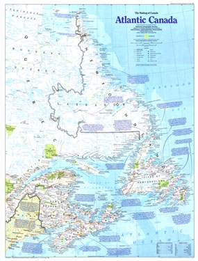
Explore the eastern-most points in North America and a land of rich and diverse cultures with this map of Atlantic Canada. Part of the "Making of Canada" series, this is half of a two-map set published in October 1993. Known for their quaint harbors and fishing villages, friendly people, vibrant music, and pristine environment, the provinces of Atlantic Canada make for a fantastic vacation destination.

The 1993 Atlantic Canada map Side 1 features:
• Historical notes
• Indian reserves, national parks, provincial parks, and wildlife areas
• Capitals, cities, and towns
• Mountains, rivers, lakes, and swamps
• Limited-access highways, roads, passenger railroads, ferry routes, airports, and airfields
• Ocean bathymetry

Coverage Area: Newfoundland, Labrador, Nova Scotia, New Brunswick, Prince Edward Island, eastern Quebec

More Product Details

This map requires 7 business days to print and laminate prior to shipping.

Appearing in the October 1993 issue of the National Geographic Magazine, this Atlantic Canada map has been reproduced from its original cartography in order to bring to life a beautiful poster previously only seen in National Geographic Magazine. This reproduction holds true to the high standards that National Geographic Maps are known for.

Perfect for home, office or classroom, this map also makes a great gift. Map collectors will surely want to add this map to their library.

The Paper version is printed on high quaility semi-gloss paper, perfect for framing.

The Laminated version uses 3mm laminate on both sides for durability, is easy to clean and markable.

From the National Geographic Classic Maps collection, this reproduction is just one of hundreds of titles available here. These maps are Printed on Demand. Sizes are approximate and may vary due to the nature of the trimming and laminating processes.
Shipping Conditions
Maps.com ships to Dometic US only

US FlagThis product can only be shipped to the Domestic U.S.A. (No APO's or PO Boxes)
TimeThis map requires 2 business days to print and laminate prior to shipping.